


|
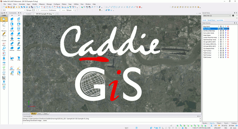
'Caddie GIS provides an unique solution, delivering seamless integration and presentation of GIS information with traditional CAD drawings and models in an intuitive and visually accessible way' |
|
Why Choose Caddie GIS |
|
Seamlessly integrated into Caddie Professional, Caddie GIS provides an uniquely tailored solution for design professionals that will dovetail effortlessly into your workflow. Whether you need just a simple 2D location plan incorporating local services and infrastructure, or a full 3D CAD building set into an aerial imagery-draped digital terrain site model, Caddie Pro+ GIS deliver the tools you need. Stream Google, Bing, OpenStreetMap and Ordnance Survey raster tiles directly into your CAD drawings.
Caddie Pro + GIS is your perfect solution for information procurement, production, assimilation, and presentation. Read vector SHP files direct, or add data sources to your own local, or Cloud Databases to minimise online storage costs. Combine data sources to construct that comprehensive appraisal of a location or area based on the latest information available. |
|
|
Caddie GIS Features and Benefits |
|
Assign Coordinate Reference System (CRS) from Map or List view with auto-filtering on location search for fast and easy CRS identification. Saved Recent CRS list makes repeat searches simple. Satellite image tiling based on location for enhanced identification within location searches. Geometric and Projected CRS support including ESRI and EPSG Location change without CRS reset for simpler multi-location searches. Coordinate import and plotting with conversion from WGS84 to current CRS for accurate geographic locating. Write Points to table and export Points to file for easy information presentation and transfer.
Query and write to drawing provide the facility to record external GIS information in proposals. Measure distance, bearing in units of choice for any CRS, and Latitude and Longitude in DMS or decimal degrees with on-pointer display and write to Windows Clipboard. SQL query with selection by GIS property allows dynamic filtering by database entry. |
|
'Caddie GIS helps you gain a more profound understanding of an area, and with it develop more sustainable, coherent, and appropriate solutions for that area, its community, and the infrastructure that serves it' |
|
Simple to use |
|
To make accessing data simple, Caddie GIS incorporates pre-defined links for accessing popular raster and vector data sources. Using Caddie GIS users can access and information from a wide variety of sources, reading information directly into their normal .dwg CAD drawings for interrogation and incorporation into their schemes and projects... |
|
|
|
|
|
|
|
All trademarks acknowledged
Contains OS data © Crown copyright and database rights 2021, image(s) from Google Maps and OpenStreetMap.