
Why Choose Caddie GIS?
GIS is an industry in its own right, replete with systems designed for those concerned only with the pursuit and portrayal of information.
However, for many professionals, GIS is more the beginning of the journey that is their design process. A journey that begins with the assembly and analysis of data, progressing through concept, scheme and approval, to the realisation of an informed solution on site.
Specifically, for the designers, Caddie GIS provides an unique solution to the problem of combining the access and assimilation of GIS data with the speed, functionality, and compatibility of a full featured CAD system.
Caddie GIS also includes PostGIS, MySQL and Oracle database support to enable you to create, control and access your own data without penalty or ongoing Cloud storage costs, plus access to data sources stored in the Caddie GIS database on Amazon Web Servers.
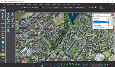 Google and Bing - Hybrid and Satellite Mapping | 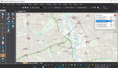 OS Road Leisure, Outdoor and Light Mapping |
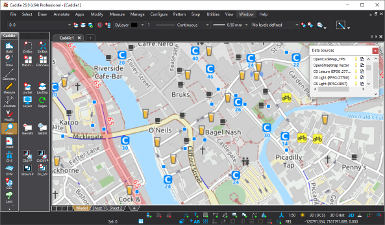 OpenStreetMap Raster & Vector Mapping | 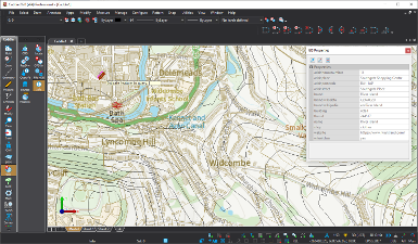 Shape Files Read + GIS Query and Filtering |
How Could Using GIS Benefit Me?
Even if you only ever consult the weather, or search for the fastest map route, then you're probably already using GIS. So let GIS work for you, and make sourcing, analysing and presenting accurate geographical information faster and easier than ever before
By using GIS, you can link data to geographic location, overlay maps and information such as boundaries, buildings, roads, flood plains, contours and much more, building up layers of information that can prove invaluable in developing a comprehensive picture of the sites and locations you work on. And using Caddie GIS' powerful interrogation tools you can develop an even deeper understanding, accessing not only the mapping data, but also the associated data files that include information on, ownership, status, areas and heights that provide the all-important context and allow bigger picture interpretations.
Caddie Geographic Information System (GIS) Provides You With Tools To:
Integrate GIS into your normal drawing function
Caddie offers the best of both worlds. In addition to all the normal CAD tools, Caddie GIS enables you to use maps and other geographic representations, tools, and technologies to acquire, process, and report on information from a spatial perspective.
Set an appropriate Coordinate Reference System (CRS)
The CRS chosen will depend on many factors and may be changed depending on the task in hand. For example Satellite Imagery tile services are normally served by Google and Microsoft in EPSG:3857. However, that projection does not allow for accurate use of the normal CAD drawing tools since depending on the location in the world, points the same distance apart in a CAD system will measure differently. Conversely, when using a Transverse Mercator projection such as EPSG:27700 (UK National Grid), or EPSG:2053 (LO29), all the normal Caddie tools can be accurately used, but some tile services will require the imagery to be re-projected.
Caddie GIS functionality has many ways to determine an appropriate CRS to use. These include:
- Picking from a list (if you know which you want)
- Choosing a location on a map and choosing from those that are valid for that location
- Typing in the latitude and longitude and choosing from those that are valid for that location
- Having Caddie determine your current location and choosing from those that are valid for that location
- Searching a database of known locations and choosing from those that are valid for that location
Caddie supports both projected and geometric CRSs defined by both European Petroleum Survey Group (EPSG) and Environmental Systems Research Institute (ESRI).
Convert data between different coordinate systems or combine data coming from different coordinate systems (Reprojecting)
Mapping such as Google maps or Bing maps delivers tiles in EPSG:3857 Coordinate Reference System (CRS) so if you wish to superimpose schemes accurately over this type of imagery you must first convert your work to that CRS.
Conversely, if you wish to derive site data by tracing over (say) Google Maps then use that in a scheme in a CRS in which you can use Caddie's normal drawing, measuring and survey tools, you will need to convert that site data from EPSG:3857 to your chosen CRS.
Relocate survey or site information
Relocate survey or site information (that may have been generated from Surveyor General diagrams, drawn manually at no particular geographic location, or other sources) within the drawing to the correct location in a chosen CRS.
Read and Write GIS Properties and Attributes
In addition to graphical objects, GIS data sources often hold numeric or textual information (properties or attributes) pertaining to the objects. Depending on the type of data source, Caddie GIS allows you to access that information, write it on the drawing, run queries against that information, edit the information and add additional properties.
Take control of your data
GIS data does not just have to be read-only. If you use data sources from third parties then they generally take responsibility for maintaining the data and you can read it. However, if you create your own data sources then you can decide what data is stored against every object in the database and change or update it as required. GIS becomes a lot more powerful and beneficial when you take control of the data.
Measure
When using a Transverse Mercator CRS, as long as the units used correspond to that of the CRS definition, then you can safely use Caddie's measure tools.
However, when using a CRS such as EPSG:3857, which is the CRS required for most satellite imagery, then for accurate measurement, the specific GIS measure tools must be used.
It can also be useful for many purposes to interrogate points on the drawing and obtain their Latitude and Longitude, which can either be displayed on screen or written onto the drawing.
Manage Data
There is an enormous amount of GIS data available for use within your Caddie drawings. However there may be times when you need to represent your own data. for example tree surveys and management.
You may have a need to collect, plot, analyse and present your own data that is georeferenced. Caddie's GIS is a great tool for this, linking many applications together to present a complete picture which can be created and updated as required.
Share Data
Export data to Google Earth for quick easy sharing with clients and partners with no GIS solution themelves
A shapefile is often a convenient way to share geospatial data with other users of GIS systems. Caddie allows you to create a shapefile from a geo-referenced drawing.
Many portable GPS devices can be used to log locations or tracks, and the points, or tracks logged can be exported to a txt file or Excel spreadsheet. Caddie's 'GPS In' command can read these points or tracks and then add them to a spatial database, thus creating a new GIS data source. Several sets of data can be appended to the same data source as required.
Excel is often used for recording data in a tabular form and is a well known tool for many people. An Excel spreadsheet can be used to capture new or updated data relating to existing objects in a spatial database, then this data can be imported into the database, thus updating the properties or attributes.
Caddie Professional + Caddie GIS is your perfect solution for information procurement, production, assimilation and presentation.