


|
'Put simply, GIS or Geographic Information System is a application for accessing, assembling and analysing information' |
How Could Using GIS Benefit Me |
|
Well, even if you only ever consult the weather, or search for the fastest map route, then you're probably already using GIS. By using GIS, you can link data to geographic location, overlay maps and information such as boundaries, buildings, roads, flood plains, contours and much more, building up layers of information that can prove invaluable in developing a comprehensive picture of the sites and locations you work on. And using Caddie GIS' powerful interrogation tools you can develop an even deeper understanding, accessing not only the mapping data, but also the associated data files that include information on, ownership, status, areas and heights that provide the all-important context and allow bigger picture interpretations. |
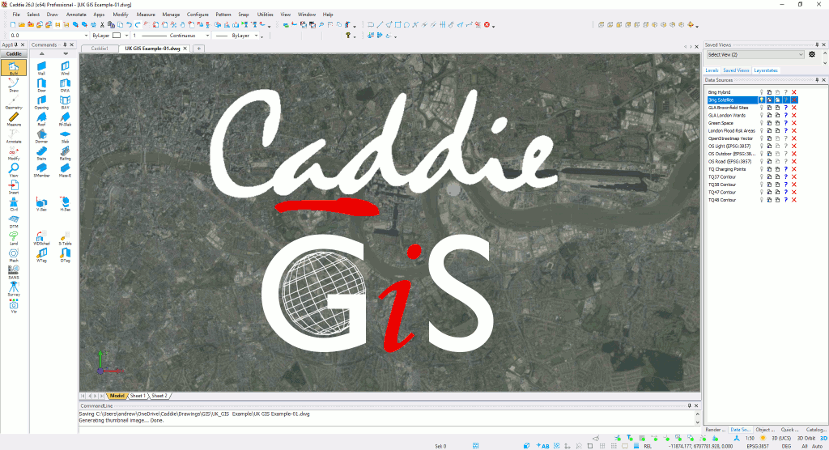
Why Choose Caddie GIS |
|
GIS is an industry in its own right, replete with systems designed for those concerned only with the pursuit and portrayal of information. However, for many professionals, GIS is more the beginning of the journey that is their design process. A journey that begins with the assembly and analysis of data, progressing through concept, scheme and approval to the realisation of an informed solution on site. Specifically, for the designers, Caddie GIS provides an unique solution to the problem of combining the access and assimilation of GIS data with the speed, functionality, and compatibility of a full feature CAD system. Caddie GIS also includes PostGIS and MySQL database support to enable you to create, control and access your own data without penalty or ongoing Cloud storage costs, plus access to data sources stored in the Caddie GIS database on Amazon Web Server. |
|
'Caddie GIS helps you gain a more profound understanding of an area, and with it develop more sustainable, coherent, and appropriate solutions for that area, its community, and the infrastructure that serves it' |
Simple to use |
| To make accessing data simple, Caddie GIS incorporates pre-defined links for accessing popular raster and vector data sources, including; |

|

|
|

|
 Shape Files Read + GIS Query and Filtering Shape Files Read + GIS Query and Filtering |
Data Layering, Filtering and Interrogation |
|
Using Caddie GIS, you can select, switch and study multiple data sources simultaneously, layering information to create snapshots in, and narratives through time that are limited only by the data sources you include and how you choose to combine and present them. Caddie GIS provides the tools you need to distil and interrogate your data too, enabling the easy identification, filtering and selection of GIS objects by individual or common property, as well as the presentation and write of non-geographic information to your drawings. |
Total GIS-CAD Integration |
|
Accessing and presenting GIS information is not new. However, the ability to be able to access, analyse, and present GIS data in a form completely integrated with the 2D CAD drawing and 3D CAD models that otherwise define a project delivers both GIS and CAD to a new level. |
|
'Caddie GIS provides an unique solution, delivering seamless integration and presentation of GIS information with traditional CAD drawings and models in an intuitive and visually accessible way' |
All trademarks acknowledged
Contains OS data © Crown copyright and database rights 2021, image(s) from Google Maps and OpenStreetMap.